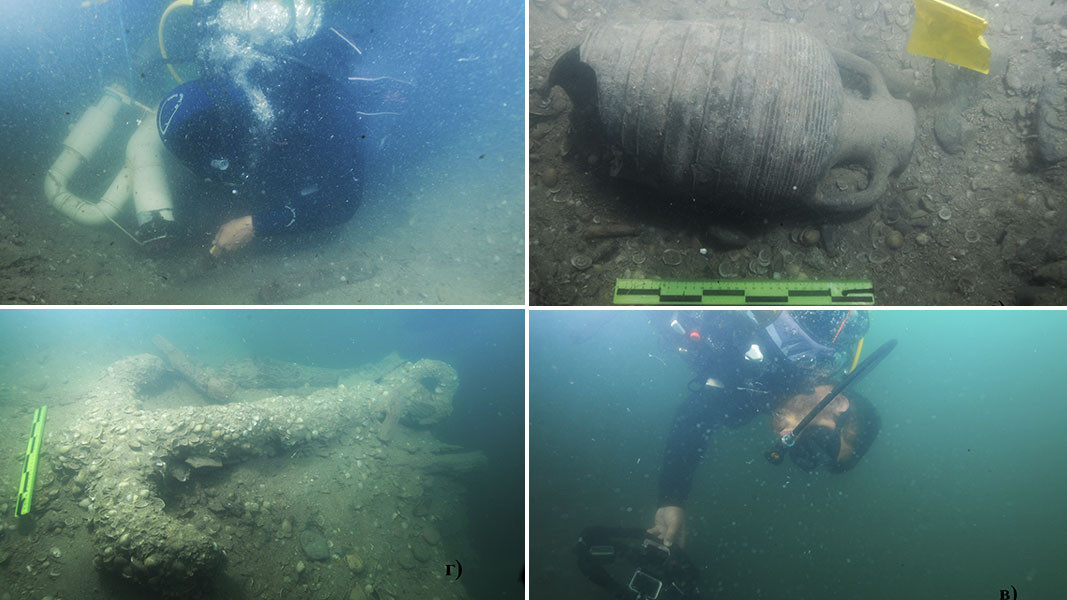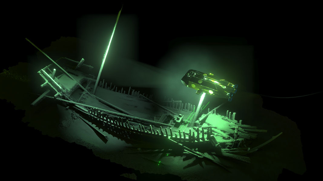
Bulgaria’s eastern borders are shaped by the waters of the Black Sea. That is why there are many legends about this sea. One legend has it that it is named Black Sea due to the multiple shipwrecks that occurred in its waters. Billionaire Hans K. Rausing, founder of Expedition and Education Foundation is trying to learn more about the secrets kept in the waters of the Black Sea. Hans K. Rausing established and sponsored the Black Sea MAP- one of the world’s biggest projects for marine archaeology. It is headed by Professor Jon Adams from the University of Southampton. According to the initial plans, the project had to be fulfilled in Turkey. However, due to problems with the Turkish bureaucracy the team decided to carry out this research in the Bulgarian section of the Black Sea. Bulgaria solved quickly all administrative issues and gave a green light to the researches which lasted from 2015 until 2017. In Bulgaria the Black Sea Map project is headed by Associate Professor Lyudmil Vagalinski, who served at that time as Director of the National Archaeological Institute with Museum at the Bulgarian Academy of Sciences and Dr. Kalin Dimitrov from the Centre for Underwater Archaeology in Sozopol. The researchers carried out their works with the most cutting-edge technologies and equipment placed on a remote controlled robotic platform which moves over the sea bottom. It gathers data of shipwrecks and changes in the water level of the Black Sea after the last ice age.

According to Dr. Kalin Dimitrov, the current Black Sea coast went under serious changes over that period.
 The Black Sea level had a minimum which was reached during the peak of the Ice Age- it is at a depth of 100 meters. Then, a large part of the water in the Northern Hemisphere turned into ice. During the following period when ice gradually melted down, the water level of the Black Sea rose, but the link with the Bosporus remained cut. Perhaps, at some stage the Black Sea was a freshwater sea, because the inflow of fresh water was bigger that the quantities of evaporating water. In fact, at some point, the water level of the Black Sea was higher than the water level of the Mediterranean Sea. The Bosporus was open and some water was passing through it towards the Mediterranean. Later, when the ice started to melt down, the level of the world ocean rose and the process reversed. Thus, the Black Sea became a salt-water sea.
What impresses scientists the most during the researches? More from Kalin Dimitrov:
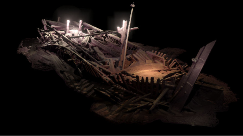
The large number of sunken wooden ships which practically cover most of the historical period and their exceptionally good condition is what impressed us the most. On the second and the third year of our research we studied 61 ships which date back to the time when the Black Sea coastline was inhabited by Greek colonies until the 19th century. These ships were found at a depth of over 2 kilometers to 40-50 kilometers in two large zones that were subject to our research. One of the zones is opposite Bulgaria’s Southern Black Sea coast and the second one is along the Northern coast, along the route of the failed South Stream gas pipeline project.

The dating of the ships coincides with the dating of the archeological sites on the land. Thus, we can determine the peaks in the economic development of the Black Sea region during the Roman and the Early-Byzantine period, the contacts with Western Europe, etc. According to evidence of shipwrecks, the first contacts with Western Europe were made in the 13th century, Dr Dimitrov says and adds:
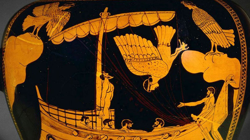
We named the earliest shipwreck Ship of Odysseus. This is a ship which dates back to the beginning of the 4th century BC and lies at a depth of nearly 1,700 meters in the northern zone. It was most likely a military or military-trade vessel. Practically, it is identical with the ship which can be seen on a very popular red-figure stamnos Greek vase kept at the British Museum. The vase depicts the ship of Odysseus passing the Sirens.

A project for excavations of archaeological site found at the end of the 1970’s in front of the delta of Ropotamo River began together with the ship researches. The village dates back to the Early Bronze Age.
The scientists hope that the underwater archaeological researches in the Black Sea will continue and that the continuation of the Black Sea MAP project will be supported by new private sponsors.
English version: Kostadin Atanasov
Photos:Black Sea MAP/ The Center for Underwater Archaeology, Sozopol